SATELLITE TELEMETRY
ECOMAR utilizes satellite telemetry to monitor the movements of sea turtles in Belize and the Wider Caribbean. The imagery provides valuable information on migration paths, foraging grounds and behavior of individual sea turtles.
What is Satellite Telemetry?
A form of radio communication with satellites used to track objects globally. The technology is primarily used by biologists, environmental and other scientists as a way to track the migratory patterns of animals for study, weather analysis, as well as by aerospace professionals to maneuver and control satellites.
All satellites have a tracking, telemetry, and control system that enables two-way communication from control systems on the ground to the satellite. The satellite sends status signals back indicating it's location, temperature, voltages, and other useful data.
WHY DO SEA TURTLES MIGRATE?
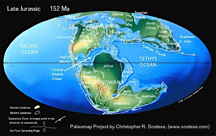
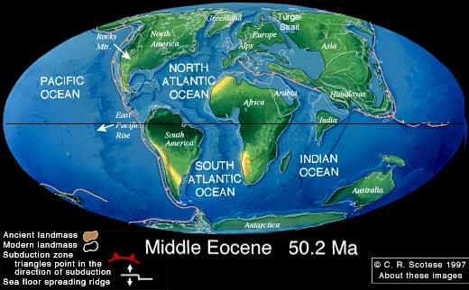
This is an interesting question and while scientists have been hypothesizing on the methods used by sea turtles to navigate great distances between nesting beaches and foraging grounds - using magnetic and sensory clues - a Venezuelan crabber explained this mystery one day and described that 150 million years ago, the continents on Earth were close together and so the distances between the nesting beaches and foraging grounds was not great then, but as the continents drift, the distance increases.
This is an interesting question and while scientists have been hypothesizing on the methods used by sea turtles to navigate great distances between nesting beaches and foraging grounds - using magnetic and sensory clues - a Venezuelan crabber explained this mystery one day and described that 150 million years ago, the continents on Earth were close together and so the distances between the nesting beaches and foraging grounds was not great then, but as the continents drift, the distance increases.
Plate tectonic maps and Continental drift animations by C. R. Scotese, PALEOMAP Project (www.scotese.com)
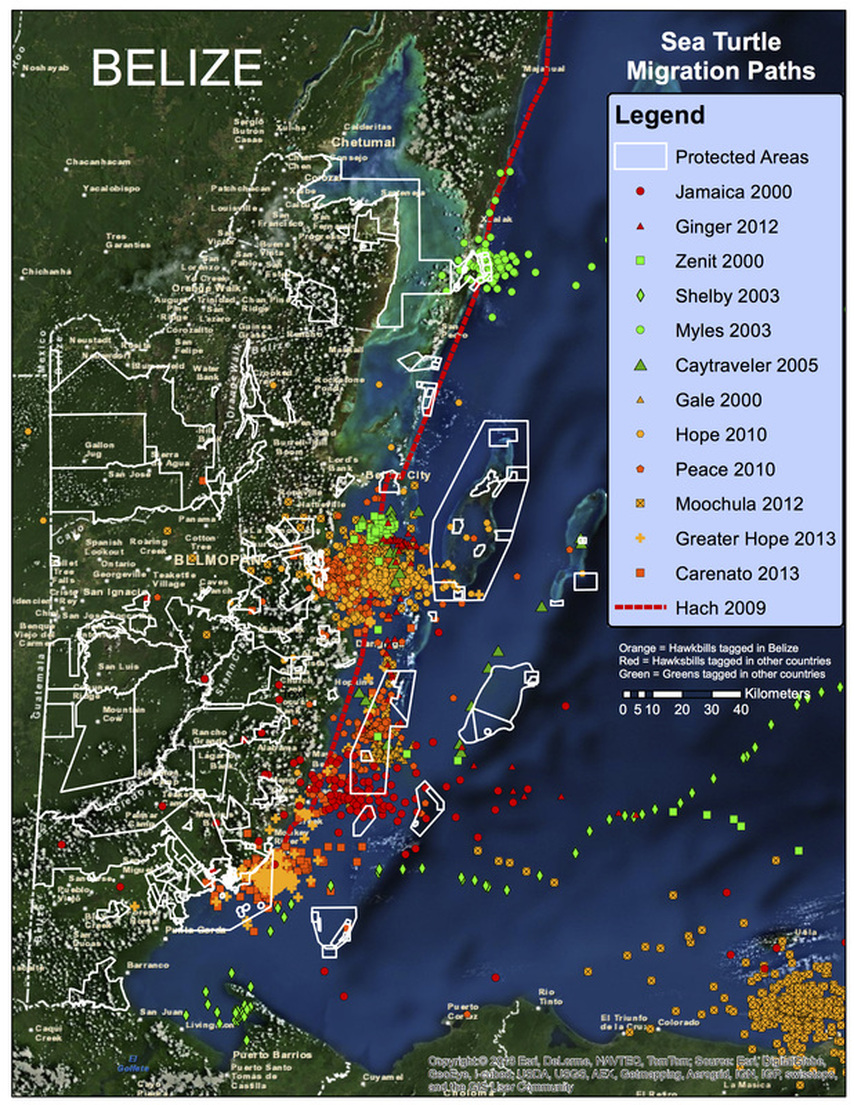
Sea Turtle Migration Paths Intersecting Belize
|
The first turtle tracked to Belize was Zenit, a green sea turtle who was tagged after nesting in Costa Rica, and travelled to Belize in about 35 days. Interesting story is that Mr Isaias Majil from the Belize Fisheries Department was part of the team that tagged her, and the story goes she followed him back to Belize, so ECOMAR could identify Robinson Point as the most important foraging ground for migrating adult sea turtles in Belize! Later that year Gale, the first hawksbill tagged in Belize, migrated to the South Water Caye Marine Reserve area. Since 2000, then there have been 21 other turtles tagged in Belize and 7 more turtles that migrated to Belize, providing valuable data on sea turtle migration patterns and the links between sea turtle nesting beaches and foraging grounds. Sea Turtle Migration Paths map summarizes sea turtle migration paths through 2013. Interestingly many of the migration paths of these sea turtles utilize the areas inside the Belize Barrier Reef.
|


